KidZone Geography
Yukon, Canada
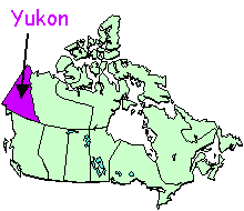 Yukon is the western-most Canadian territory. Whitehorse is the capital
city.
Yukon is the western-most Canadian territory. Whitehorse is the capital
city.
The Yukon Territory is bordered on the Western side by the U.S. State of Alaska. To the north is the Beaufort Sea and to the south is the Province of British Columbia.
Check out our brief photo tour of Yukon if you'd like to see more of the scenery of the territory or if you need photos for a school project.
You can find out a lot of interesting information about the territory at http://www.gov.yk.ca/
© Leanne Guenther
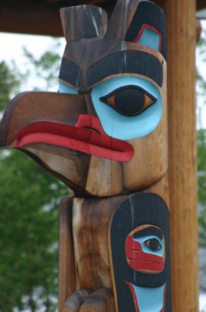
Tlingit Totem in Teslin, Yukon
Free Printable Worksheets:
- Yukon Territory flag worksheet
- Yukon Territory map and response worksheet
- Yukon map - Name the Capital City
- Yukon map - Name the Territory
- Yukon Territory official bird with labels worksheet
- Yukon Territory official bird coloring page
- Yukon Territory official flower with labels worksheet
- Yukon Territory official flower coloring page
Free On-Line Activities:
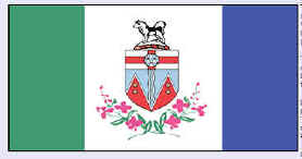 The Territorial Flag
The flag of the Yukon was adopted in 1967 as the result of a territory wide design contest. The central white panel represents the ice and snow of the region while the green and blue side panels represent the forests and lakes. The central shield is the Territorial shield.
Below the shield are two sprays of fireweed -- the territorial flower.
© Leanne Guenther
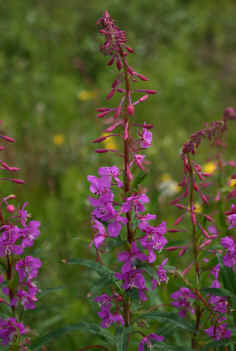
Fireweed
The Territorial Flower
Fireweed (epilobium angustifolium), was chosen as the Yukon's floral emblem in 1957. Fireweed blooms nearly all summer long and can be seen along roadsides, rivers and clearings.
The name "fireweed" comes from the fact that this plant is among the first to sprout in areas where forest fires have occurred.
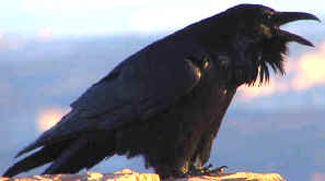 The Territorial Bird
The official bird of the Yukon is the raven (Corvus corax). It was adopted as the official bird in October, 1985.
Ravens are found throughout the territory -- feeding on carrion, leftover french fries and picnic lunches if you don't watch them closely enough (I know this one from personal experience *laugh*)
I was surprised to learn that ravens mate for life. They are large members of the crow family with glossy black feathers. They lay clutches of 4 to 7 green spotted eggs.